
Shoresearch
What is Shoresearch?
Shoresearch is The Wildlife Trusts’ user-friendly and fun Citizen Science project that combines exploration of the shore with scientific recording. It’s a great way to enjoy your local coast whilst recording the vast array of species and habitats that can be found there.
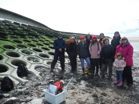
Shoresearch surveys were set up in the North West by Cumbria Wildlife Trust Marine Trainees in 2011 and since then we have carried out hundreds of surveys and have trained over 200 volunteers. Our marine officers provide Shoresearch training at specific events and at the start of each survey. Volunteers are welcome to come along to organised events but are also encouraged to carry out their own Shoresearch surveys whilst out on their local beaches and to send in their findings.

Shoresearch quadrat
Our methodology
How does it work?
We use four different survey methods. Not all are used at every survey but we always try to incorporate a walkover survey which is the best fun!
Walkover survey
A targeted, informal search of the shore from the lower shore heading towards the upper shore, with each person recording details of any species that they find within their designated zone. All findings are recorded. (You can carry out one of these yourself, please see details further down this page!)
A wealth of intertidal species has been discovered across the UK from people simply walking over the shore and having their curiosity sparked by something unusual that they have spotted as they go by. Walkover surveys are just as valuable as those involving quadrats, as they provide participants with the opportunity to explore the natural environment and to search around to discover what species live on their local shore.
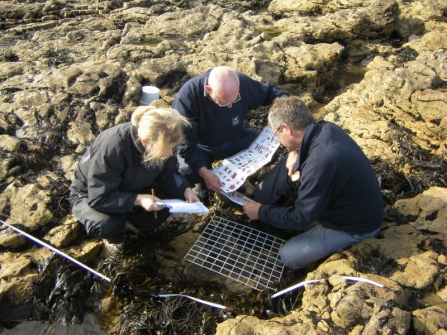
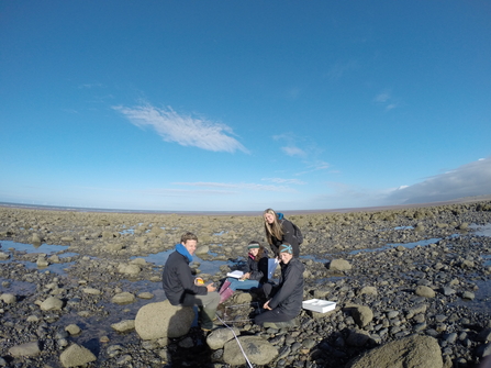
Biodiversity survey
Biodiversity surveys are based on more traditional methods of data collection for intertidal areas and therefore, produce a more comprehensive species list for the site. Using a tape measure, and walking from the low water to the high water mark, a transect is created, along which we randomly place quadrats. All habitats and species found within the quadrats are then recorded and photographed with an estimate of their abundance.
This is carried out when monitoring over a long time scale. Repeating biodiversity surveys in the same location each year can provide you with an understanding of how species may change their distribution over time.
Sediment shore survey
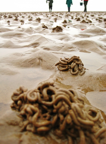
If you really want to know what lives in a sandy or muddy shore, you will need to have a look at what is living down in the sediment itself. This means digging up some of the sand or mud and extracting the animals (infauna) that live inside it. It is important to remember that, despite initial appearances, many sedimentary habitats are every bit as diverse, as highly structured and as vulnerable to damage as those which have more obvious features.
As above for the biodiversity survey, a transect is created and quadrats are placed at random along its length. Features of the habitat and species found within the quadrats are then recorded and photographed. Further to this, a core sample is taken from each station and sieved to separate all fauna which is then recorded.
Timed species search
A twenty minute search of an area of rocky shore looking for a small number of key species, using photo cards of rare and protected species, invasive non-native species and climate change indicator species. This method creates useful, comparable data. (submitted to the Marine Biological Association's Shore Thing project).
Blackpool Shoresearch 2016
Rocky Shoresearch
Shoresearch Earnse Bay 2014
Further information
Join the Shoresearch team!
We carry out Shoresearches in West Cumbria with our My Local Catch project and around Morecambe Bay with The Bay project. To take part in a Shoresearch see our events page or sign up as a volunteer via the project pages.
For more info email livingseasnw@cumbriawildlifetrust.org.uk
What happens to the data?
All the records gathered by Shoresearch volunteers are sent to the relevant Local Record Centres:
Lancashire Environment Record Network (LERN)
Cumbria Biodiversity Data Centre (CBDC)
This valuable data not only builds our knowledge of the marine environment but can also be used to inform conservation decisions at both local and national levels. It helps us monitor change on our shores and provides biological information to counter potential threats to the marine and coastal environment.
For example, this data has been particularly useful as ecological evidence for the Marine Conservation Zone designation process in England and Wales and will be vital in monitoring these areas in future. It may also be used to inform marine planning decisions on proposed offshore development and any other projects that could potentially affect the marine environment.
Who can take part?
Anyone and everyone.
If you are keen to learn and happy to give up a few hours of your time you are very welcome. Prior knowledge of marine life is not necessary, but it is still great for those that do already have a good level of knowledge.
The shore can be slippery and hard to access so you do need to be fit and mobile to take part. We also ask that under 18s are accompanied by an adult.
Carry out your own Shoresearch Survey
Whenever you are out on the shore it is easy to do your own Shoresearch. Just print out our walkover survey form and take it with you.
Remember to send your findings to your local record centre (details above) and....